
You have just bought a house and you are planning an extension, a terrace, or the installation of a new toilet. Before digging or drilling, one question arises: where exactly do the buried pipes run under your land? Without this information, the risk of cutting a drainage pipe or blocking a construction site for several days is real.
DT-DICT Regulation and Pipes on Private Land
Even before looking for a plan, it is important to know that there is a legal obligation governing work near buried networks. Since 2012, the DT-DICT regulation requires consulting the single window (reseaux-et-canalisations.ineris.fr) before digging, including on private land when there is a risk to public networks.
In practice, if you hire an excavator to install a pool or create a trench, this consultation is mandatory. The single window lists the network operators (water, gas, electricity, telecoms) present in the area. Each operator then sends you a plan of their facilities or confirms the absence of a network.
This process does not replace the search for your own private pipes (those that connect your house to the public network). However, it already helps eliminate the risk of touching a network that does not belong to you. To further explore the location of your drainage and sewer map, several additional avenues exist.

Where to Retrieve the Drainage Plan of Your House
You may have already searched through your sale documents without finding anything. This is common: previous owners do not always pass on technical documents. Several official sources can fill this gap.
Your Town Hall’s Urban Planning Service
The town hall keeps the building permit files submitted for your plot. These files often contain a site plan with the layout of the sanitation networks. Thanks to the CADA law, these archives are communicable upon simple request, with a legal response time of 30 days.
Explicitly request the execution plan for the connection to the sewer system. If the house is several decades old, the plan may be basic, but it at least provides the general direction of the pipes.
The Online Cadastre to Cross-Reference Information
The site cadastre.gouv.fr provides official parcel plans for free. You can print an excerpt of the plan or order a large format sheet. This document does not directly show the pipes, but it allows you to overlay the boundaries of your plot with the presumed layout of the networks provided by the town hall or the sanitation service.
The Public Sanitation Service
Each municipality (or intermunicipality) has a sanitation service that manages the collective network. This service has a plan of the public network, including the location of access points and collectors. By cross-referencing this plan with the position of your connection point (often located at the property boundary), you can deduce the layout of your private connection.
The Builder’s Archives
If your house was built by a contractor, they generally keep the execution plans. A call or a letter is sometimes enough to retrieve a specific document, including dimensions and drainage slopes.
Site Survey: Locating Access Points and Deducing the Layout
Even without a plan, your land contains visible clues. Access points (these plates or covers on the ground) are the most reliable starting point for reconstructing the path of your pipes.
Start by locating all the access points present on your plot. Generally, an access point is located at each change of direction or slope of the network. If you find two or three, you can draw a line between them: this is the likely path of the pipe.
Open each access point to observe the direction of water flow. A simple bucket of water poured into a sink or toilet allows you to check which access point receives the flow first. This simple method provides concrete results without any specialized equipment.
- Facade access point: collects wastewater from the house, often located against the exterior wall near the kitchen or bathroom
- Connection access point: located at the property boundary, it marks the junction between your private network and the public collector
- Intermediate inspection access point: placed at changes of direction, it allows for cleaning and maintenance of the network
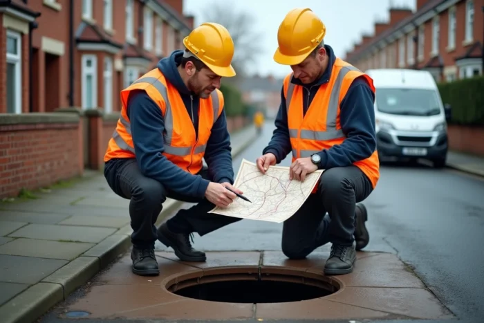
Professional Detection of Buried Pipes
When access points are impossible to find (inaccessible crawl space, filled land, garden without visible markers), a site survey by a professional becomes the safest solution.
Two technologies are commonly used. The ground-penetrating radar sends electromagnetic waves into the ground and returns an image of buried objects, including pipes. The inspection camera, on the other hand, is introduced into an existing access point and progresses inside the network to film its condition and path.
Ground-penetrating radar is particularly useful when there is no surface access to the network. The camera, however, provides information about the internal condition of the pipes (cracks, roots, deposits) in addition to the layout.
- Ground-penetrating radar: contactless detection, suitable for land without visible access points, results in 2D or 3D mapping
- Inspection camera: requires an entry point but offers a diagnosis of the network’s condition in addition to the layout
- Electromagnetic detector: effective on metal pipes or those equipped with a tracer wire, less suitable for bare PVC
A surveyor or a company specialized in network detection can carry out this survey and produce a scaled plan. This document, once established, serves as a reference for all your future work.
Keeping and Updating Your Pipe Plan
Finding the layout of your pipes represents an investment in time (or budget if you hire a professional). To avoid having to start over, keep the plan obtained with your property documents and pass it on in case of sale.
If you carry out work that modifies the network (adding an access point, extending the connection, separating wastewater and rainwater), update the plan immediately. A scaled sketch, even done by hand with distances measured from the walls of the house, is better than an approximate memory.
The sanitation diagnosis, now mandatory during real estate sales, checks the compliance of your installation. Having an updated plan facilitates this control and can prevent costly compliance requests at the time of the transaction.